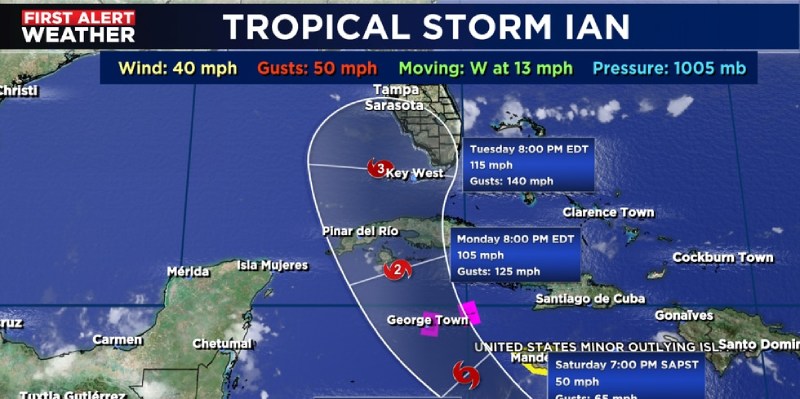
Hurricane Ian’s path through Florida will be quiet this weekend

The weekend will be calm weather, giving us everyone time to prepare for a storm. The exact date and trajectory of the growing storm are still in dispute between the American GFS and European computer models, but this storm will intensify into a hurricane and will have a significant impact on most of Florida. The final track will determine specifics about how much rain, storm surge, and winds fall. On Wednesday, the “Cone of Uncertainty” is still 300 miles wide. You can still get ready this weekend by doing the following:
- Get food and water supplies for several days
- Get prescriptions filled and have medications and a first aid kit handy
- Get enough pet food and medication for several days
- Have a radio with batteries and phone charges available
- Keep your gas tank full
- Have cash on hand
- Store important documents in a dry, safe place
- Be prepared to protect your home with hurricane shutters or other protection
The hurricane is expected to make landfall in southwest Florida early on Wednesday and might intensify into a strong Category 3 storm, according to the most recent storm forecast cone. At the storm’s centre, a Category 3 would have winds that ranged from 111 mph to 129 mph.
Through the weekend, the storm’s course will be considerably more well defined.